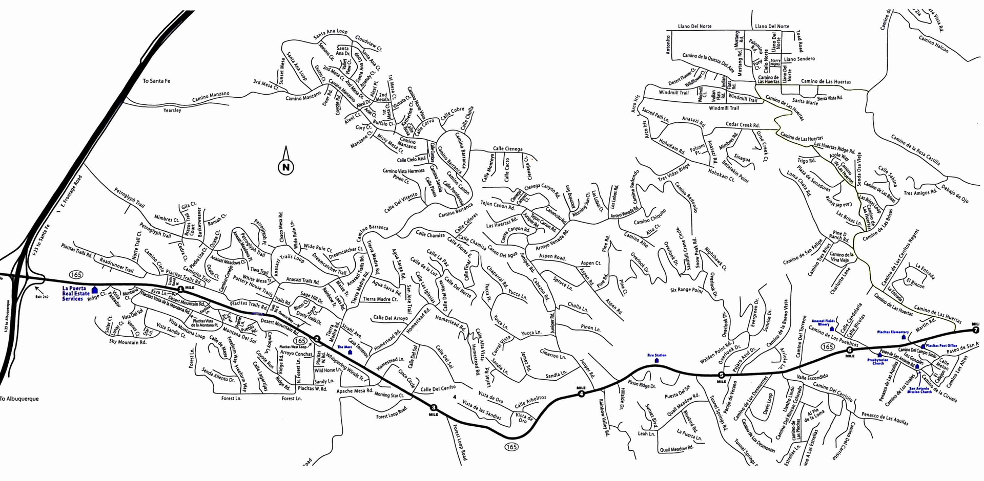
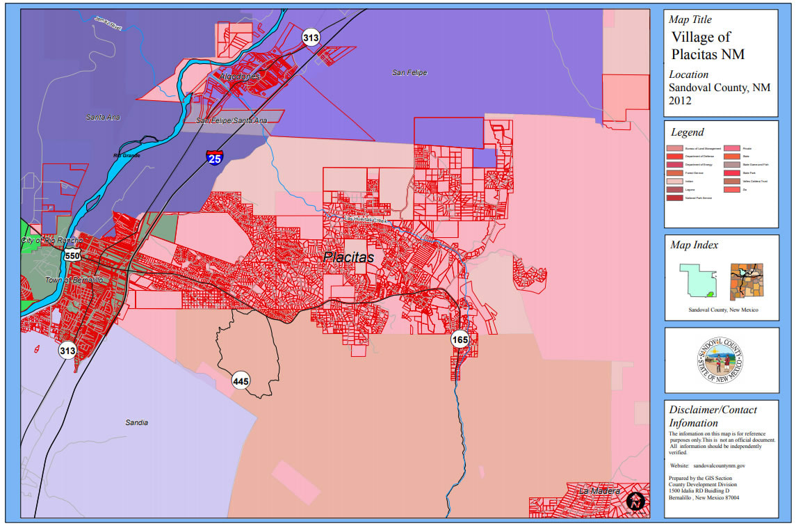
Placitas
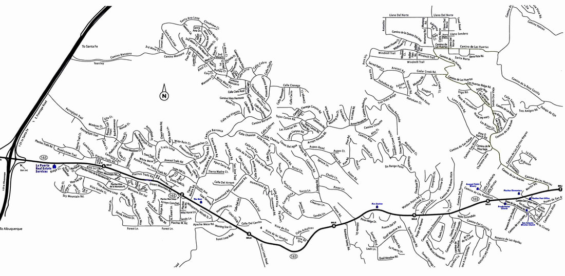
| map1-placitas.jpg |
Cedar Creek Property Boundaries

| map-properties.jpg |
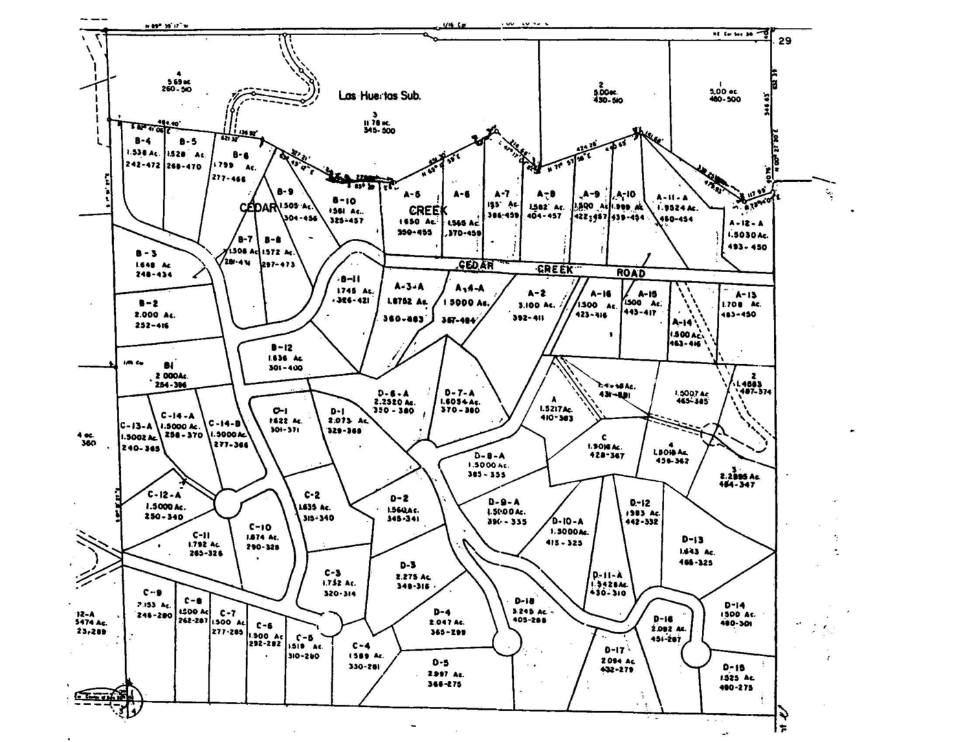
| placitas-props-pic.jpg |
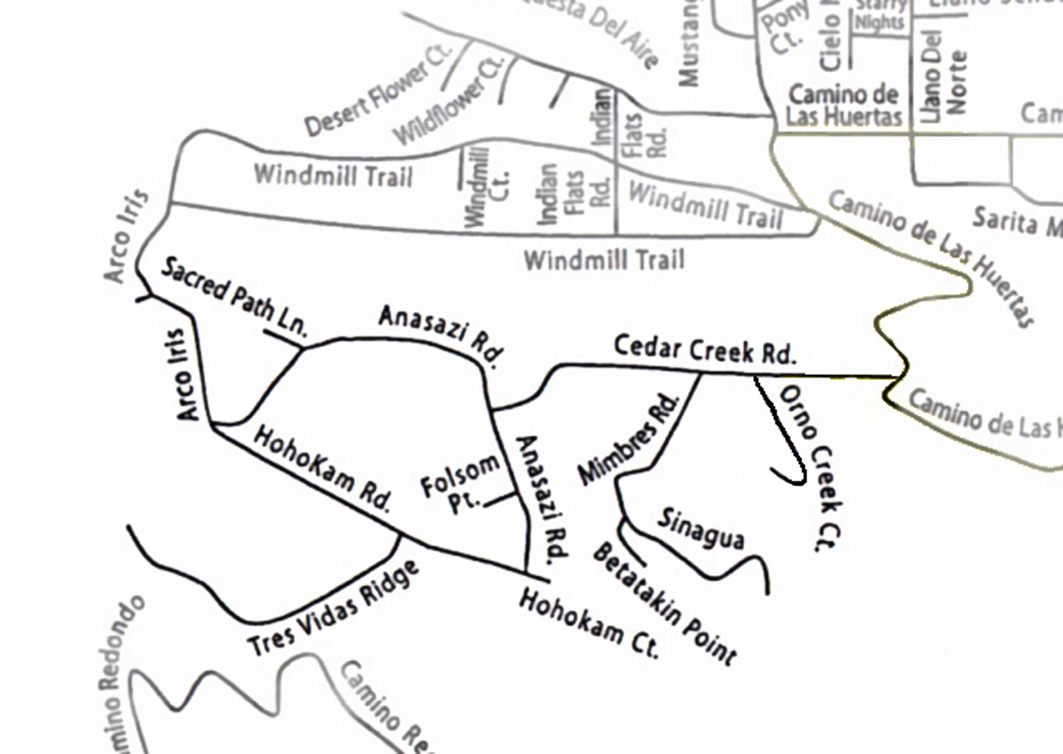
Cedar Creek Roads
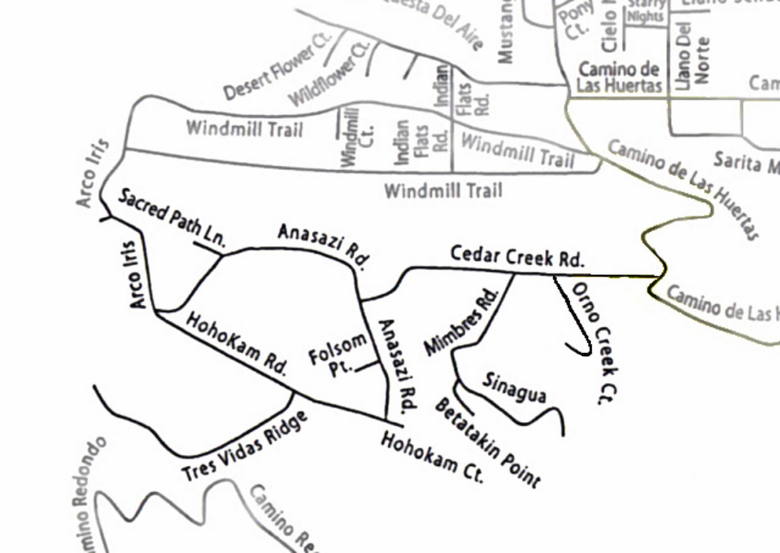
| map-cedar-creek-roads.jpg |
Sante Fe
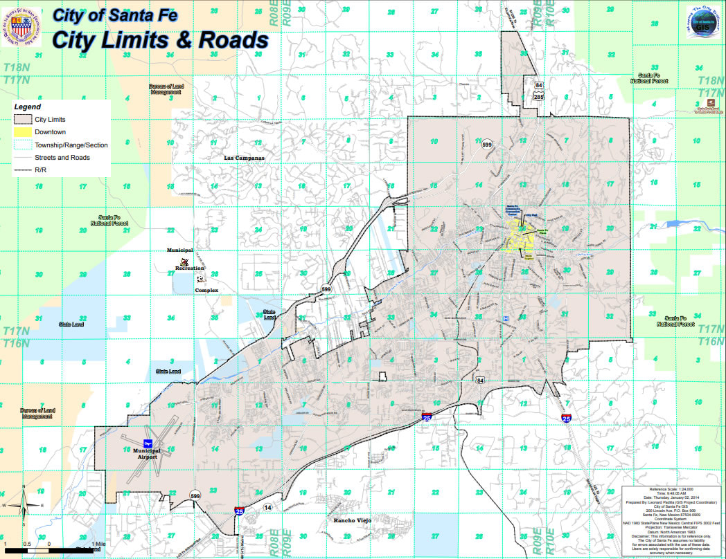
| sante-fe.pdf |
| map1-placitas.jpg |
| map-properties.jpg |
| placitas-props-pic.jpg |
| map-cedar-creek-roads.jpg |
| sante-fe.pdf |